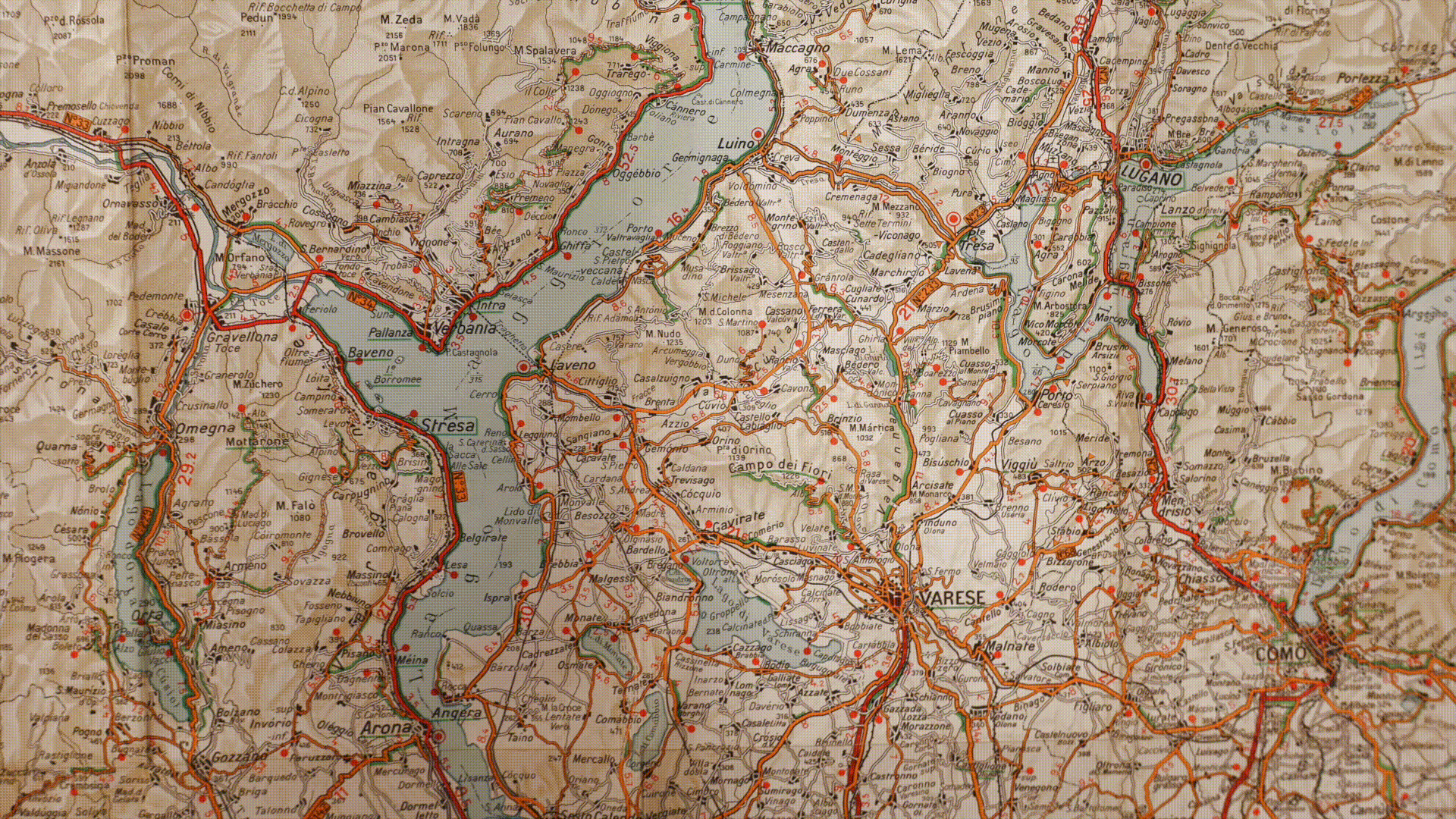
Road Recognition Algorithm
The video illustrates the steps of an algorithm I developed to extract and geolocate road networks from historical driving maps. The map, from 1971, depicts the Varese region in Italy at a scale of 1:200.000. The algorithm identifies the map's structure, isolates main roads (red/orange) and secondary roads (white), and geolocates these features. This process transforms static maps into datasets that quantify road network extension and capture how administrative units were interconnected.
FlexyMatch Package
(in development)
FlexyMatch is an R package built for efficient and highly customizable fuzzy matching of text and string data. By utilizing tokenization, string similarity metrics, and adaptable scoring algorithms, it enables the identification of approximate matches across datasets, even when the input contains inconsistencies or minor variations. Particularly, FlexyMatch incorporates multiple algorithms based on various string distance measures, allowing it to handle different types of mismatches effectively.